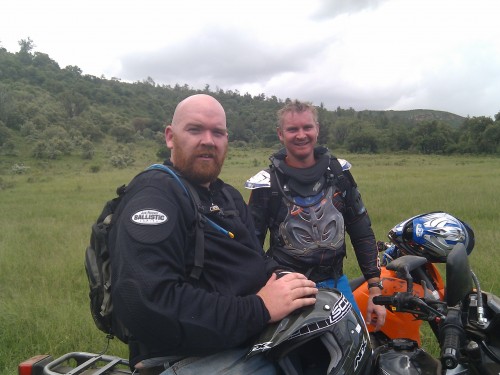
The roads are dirt and with the recent rains they’re really quite rugged and beyond most normal vehicles. Markus is an experienced trail rider on a KTM 450 (kitted out), I’ve ridden a lot of trails, but years ago and not nearly as experienced as Markus – and I’m riding an offroad/onroad Suzuki DR 650 (stock).
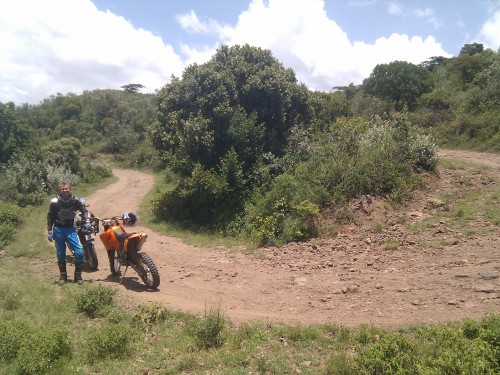
We ended up having to run through, and beside, a lot of 5-10 acre farms that sit at the base of the escarpment in order to find a road up to the top of the escarpment. A lot of this was on cow paths and required some fine-tuned leveraging of our bikes through gates and streams. The road to the top of the escarpment, when found was a fun ride, minus the part where I wiped out on a simple turn (the one below)…
Bruises (and bruised ego) aside, we kept going up into small-farm, where quite a few more people live, and which is almost entirely denuded of trees that were there just 15 years ago.
After talking to some of the local community, we were advised to head down a certain road, with assurances that it would lead us to the bottom of the escarpment. It did, eventually, but not until we had backtracked, sidetracked, followed animal trails (in buffalo country), and then realized that the washed out gully we were in was supposed to be the road.
3.5 hours of wrestling a mammoth 650cc bike through this terrain left me exhausted. This type of bike is not made for that level of technical riding down boulder strewn gully’s and game trails. However, it was also hugely rewarding when we finally found our way to the bottom of the escarpment and much easier riding.
Mapping the Malewa Motorcycle Trip
I also brought my Android Nexus One along for the ride, hoping that the battery life would allow me to use it for tracking our trip. The Nexus One has a GPS, and there’s an Android app called My Tracks, that tracks your trip, allows you to add waypoints, then easily shares it to Google’s MyMaps.
Here is the result:
View Malewa Motorcycle Trip in a larger map
It doesn’t look very exciting like that, but it does give you the exact data for having your own challenging ride if you’re in Kenya.
]]>Google continues getting Africa on the map
Google Maps was launched in 30 Sub-Saharan African countries. That’s an amazing asset for everyone to use, and it’s also an incredible testament to the number of users using their “My Maps” feature, as this is where this data comes from.
On the growth of tech hubs in Africa
Rebecca Wanjiku wrote an article on IDG about, “Tech labs move beyond corporations in sub-Saharan Africa“. She’s a member of the Nairobi iHub advisory group, and has more insight than most in this space.
South Africa’s Design Indaba
It’s happening right now in Cape Town (Feb 24 – 26, 2010). Great design, and great speakers, but I was really intrigued by their kids program.
Location based service launches in Nigeria
StarTrack is a new location based tracking service in Nigeria, Loy Okezie has a good overview of this new service from Starcomms.
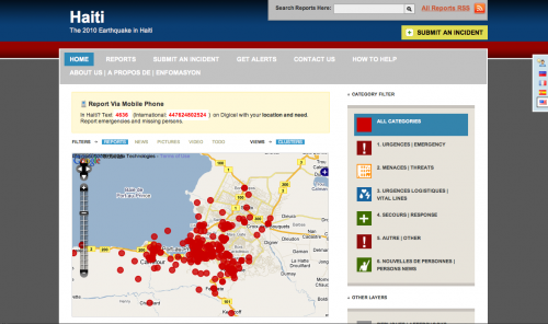
Ushahidi is heavily involved in mapping and integrating crowdsourced information from Haiti into an aggregated map that is being used by both people on the ground who need help and those who can provide relief. Teams of volunteers in Kenya, Uganda and the US have been working to solidify the platform and make this effort work. Keep up-to-date in our Situation Room and our blog.
Though it’s not a completely accurate description of what we’re doing, it’s close: We’re running what’s basically the 911 system for Haiti through a local shortcode on the Digicel network 4636. More on the 4636 number and campaign.
How you can help
Pass this message on, try to get it to people, media and organizations IN Haiti:
“In Haiti? Text 4636 (International:447624802524) on Digicel with your location and need. Report emergencies and missing persons.”
Help with open mapping of Haiti campaign through OpenStreetMap, CrisisMapping Network and CrisisCommons via the “Drawing Together” campaign.
Other links you should know about
Missing persons index
In-Haiti relief organization registry
Twitter Tracker/Filter
Crowdsourced facial recognition
OpenStreetMap Haiti
Crisis Commons Haiti
ICT4Peace – useful links wiki
It turns out this little experiment that started two years ago to crowdsource information from the public in Kenya during the post-election violence might have a future after all… 
Thanks for your support, and for your help.
]]>A lot of our discussion was centered around location, especially since he was thinking of the Ft. Hood shootings and the value of location in determining useful information from the Twitter stream during that crisis. This is what we’ve built Ushahidi around of course, the idea that location and even small bits of information give us a better understanding of an unfolding crisis. This is just as true of mundane information, or trending topics in a locale, which is why Twitter is building a new geo infrastructure. It couldn’t be in better hands either, with both Ryan Sarver and Schuyler Erle on the team, what Twitter puts out will be top notch.
What was more interesting than just geographical references for information was the combination of two other big ways to parse this data: Time an Tags. We’ve started to see a lot more apps mixing time and location in the past year or two, and we’ll see more as the visualizations for it improve. Categorizing information, pictures and video by keywords (tags) have been around even longer.
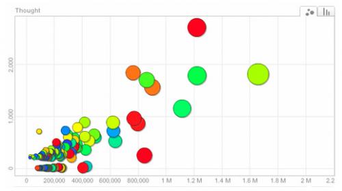
We need to see more combinations of tags, time and location in visualizations and platforms. I can’t think of anyone who does all three really well (if you can, please leave the link), though there are a number who do two of them incredibly well – including Flickr’s geocoding of images (tag + location), TwitterThoughts (tag + time) and TwitterVision (time + location), etc.
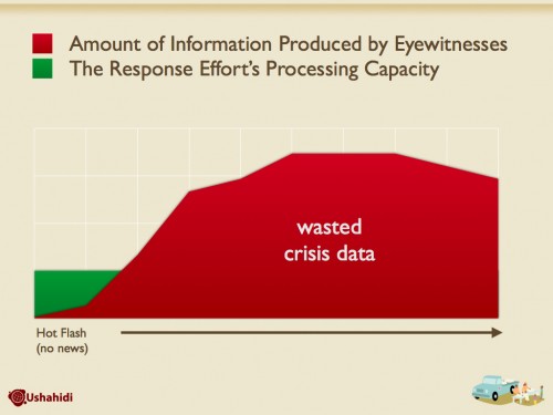
We have a widening stream of information. The lowered barriers for entry globally, and the encouragement by social tools, means we’re seeing exponential growth rates. Twitter alone saw an increase from 2.4 to 26 million tweets per day in just the last 8 months. We need some way to make sense of this information. Our ability to create information has far surpassed our ability to understand it in a timely manner.
Chris Blow outlined this best with a visual for Swift River for use in a presentation I did at TED this year:
It’s a serious problem and one that only gets deeper with every month that passes. In most areas, it’s not a big deal, but when a crisis, emergency or disaster hits the misinformation and lack of understanding has very real consequences.
I’d love to see more work being done with all three: Time, Tags and Location.
]]>How it Works
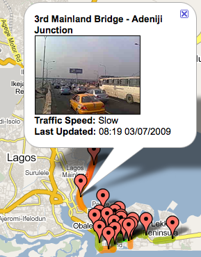 Armed with a mobile phone, a team of 4-6 motorcyclists ride to different, pre-designate parts of the city. They take pictures of the current traffic conditions and MMS that image to the central office. That image is then geolocated and given a score of “slow”, “moving” or “free”. Anyone who has signed up for SMS or email alerts is then sent a message with the traffic update.
Challenges
I asked Simon, one of the people putting the service into action, what some of their challenges are. His reply:
“Collecting information in this way, although not that technical (lots of people have said why not use stationary webcams it would be technically superior), is turning out to be more difficult than we expected. Finding people who can grasp the concept behind the service, ride well through the crazy Lagos traffic, and are reliable has been tricky, added to that we’ve had lots of issues around harassment and even arrests from the police (many police officers apparently believe you need special police permission to take photos of traffic) and just recently the weather has been in our way as the rainy season has just started in Lagos making operations more difficult and a few phones have been dropped in puddles! “
The business side
eNowNow doesn’t see much value in charging premium SMS rates for their services. They believe margins are low, and they don’t think the uptake would be high enough amongst their target market to make it work. Instead, they have plans to subsidize the service with revenues from licensing traffic information to Sat Nav providers and logistics companies.
“In Nigeria the networks will take anything between 40 and 75% of a premium SMS’s cost to a subscriber for themselves (pull or push) leaving you a tiny margin for profitability and driving the industry standard (and therefore what the networks will allow you) per SMS cost higher. Most people think that traffic only affects those in cars and they can therefore afford to pay for a service, but most of Lagos’ population aren’t in that bracket and those on public transport still have choices about which buses they take, which routes and what time they leave work.”
Thoughts and ideas
Maybe it’s because I’m a motorcycle fan, or maybe it’s because I have a deeply ingrained detestation for being stuck in traffic in Africa’s mega cities, but this application hits the sweet spot for me. I’ve been wanting just this type of thing in Nairobi for a long time…
One additional idea, to make this even more dynamic, and spread it over the whole city is to create a way for ordinary drivers to text into the system when they come across a new or growing traffic problem. I imagine that Lagos has areas with traffic that is not on the pre-designated points that eNowNow operates in currently.
This is a classic locally grown tech initiative, and I hope that they can pull it off. If so, it can definitely be replicated in other major metro markets across the continent.
]]>There are now 27 more African countries that now have detailed maps, including:
Benin, Botswana, Burkina Faso, Burundi, Cameroon, Cape Verde, Central African Republic, Chad, Democratic Republic of the Congo, Djibouti, Eritrea, Ethiopia, Gabon, Guinea, Gambia, Ghana, Ivory Coast, Madagascar, Malawi, Mauritania, Mozambique, Niger, Nigeria, Reunion, Sierra Leone, Somalia, and Togo.
Comparing countries
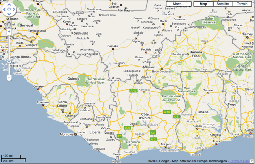
What I wanted to do was compare old map tiles with new ones, but I didn’t have any screenshots to do that with. Instead I did a quick comparison of a few countries – those that were just announced vs ones that weren’t on the list.
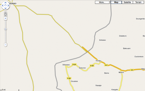
A good example of this is found when comparing Mali to Burkina Faso in West Africa. There are significantly more town names in Burkina Faso, and all the roads either have names or numbers. In Mali, which hasn’t been done yet, there are some major roads outlined, few towns are named, and no minor roads to speak of.
Also of interest, you’ll notice how the roads that should intersect at the borders, do not.
Here’s another interesting view of West Africa. You can clearly see that there has been a lot of data added for all of these countries, except for Liberia and Mali.
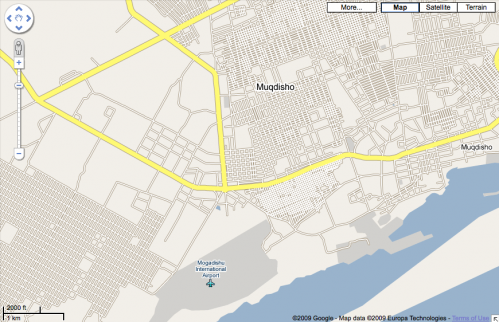
One other interesting map that I came across was of Mogadishu, Somalia. It appears that there either are no street names, or that the Google team working on this didn’t know what they were:
]]>What’s always seemed to be missing is a way for location, mobile phones and social networks to coalesce. A way for you to communicate with people, be it updates, comments or chat – and then apply location to that as you chose. Those social networks that tried to do it all couldn’t do it at this level, because they didn’t have critical mass (such as Brightkite). Those that had reach, like Twitter or Facebook, don’t have a simple way to play with location for everyone.
Enter Google Latitude
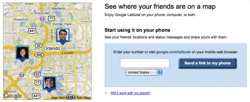
Just over a week ago, Google Latitude launched. It’s a location-based service that mashes up Google’s own mapping products with Google’s communication products; Gmail and gTalk (chat). One week later, they announced that a million people were already using the service in the 27 countries that they had released it into.
While people are discussing how great the technology works, and it does seem to be quite impressive if you carry one of the supported smart phones platforms (BlackBerry, Windows Mobile, Symbian and Android), I believe there’s something even bigger going on here. Google has not had much success in the social network space, so they are taking a rather nontraditional approach to getting embedded into people’s lives at a much more foundational level. Gmail has a base of 50 million+ accounts, and each comes with a chat service, which has gained quite a bit of popularity. Not to mention, SMS was enabled within chat just a couple months ago, in December.
What Google appears to be doing, is leveraging its massive user base, tied together through email and chat services, and pairing it together into a larger community that works within it’s mapping infrastructure.
(Putting on my Ushahidi hat, this has some pretty big ramifications for disaster and emergency work in locations where Google use is heavy.)
The competition
It also has the potential to change the game for some other large services. What happens if people start using Google Latitude for their status updates instead of Twitter and Facebook? What service do you use to find out what’s happening on a Friday night?
It will be very interesting to see what types of reactions to this service arise out of the large social networks, especially those with a large international footprint. Getting location, mobile and social networks to play together isn’t easy, yet these organizations will not sit by as Google whittles away at their empire.
Here’s something to think about. If you didn’t realize this before, pay attention: the big international showdown in this space is between Google and Nokia in the coming years. They have been gaming each other for over two years, and as the race to the edges begins, you’ll see them come head-to-head more often.
1.5 years ago Nokia bought mapping service Navteq in a mega-deal at over $8 billion. Last summer they launched Ovi, which allows remote sync capability for photos, contacts and calender, gains access to music and games, and marries up their mapping and sharing capabilities. It’s what Nokia is banking on for their consumer value-added services in the future.
I’m not sure who will win out on usage in the end, but I do think that Google’s Latitude is an incredibly strong and under-the-radar type play that should be watched very closely. One thing is for sure though, the organization that opens up for easy third-party development on their platform will have a better chance.
]]>
Unlike many of you, I have little knowledge of farming and have no agrarian pastimes. So, though the mapping and techie side of me thinks it’s really a neat project, I didn’t know why it was needed. Apparently, one of the biggest problems with food scarcity in Africa is lack of knowledge on soil degradation and the low-yielding crops that these areas generate. This information is critical to identify the types and amounts of mineral and organic nutrient sources needed to increase crop yields.
Digging deeper
I started trying to find out more about soil mapping in Africa, and came across the European Digital Archive of Soil Maps. It turns out they have an amazing number of scanned geological maps for almost every African nation.
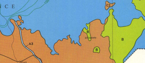
I decided to look up my childhood stomping grounds of Kapoeta, a dusty (tiny) town in the Equatoria Province of Southern Sudan. Sure enough, I found a hydrogeological map (circa 1989) with some good information:
It turns out that Kapoeta is a bit of an anomaly, in that you won’t find too many areas in Southern Sudan with as much geological diversity. It’s just off the major flood planes, and it there are 3 different types of hydrageological structures within the area. The local Taposa tribe stores their wealth in cows, but they do grow some millet.
Though that data means very little to me, in the right hands it can make the difference between a large annual millet yield, or possibly even the introduction of a new crop that locals didn’t know about. It’s in places like Kapoeta that this project will see it’s true potential.
Digitizing Africa
I was happy to see the following quote in the press release:
“All soil information will be collected and made available via the Internet in a user-friendly manner. AfSIS experts will offer training to agricultural extension agents and others on how to interpret and translate information provided by the soil map for practical application.”
As we get more open and available data on Africa – be it soil, vote counts or census information – more value added services will be created. Businesses can grow up around both the data collection and its use. More importantly, with the use of other tech tools, I think we’ll find that the information that is aggregated and then acted upon, will start to make it’s way back into the hands of those who need it for their daily living. This soil project just might be a greater thing than we realize.
]]>