The Map-the-World and Map-Maker teams at Google have been making some major, and much needed, additions for Africa. With a large data push yesterday, Google Maps has one of the most impressive sets of maps on Africa that you can find.
There are now 27 more African countries that now have detailed maps, including:
Benin, Botswana, Burkina Faso, Burundi, Cameroon, Cape Verde, Central African Republic, Chad, Democratic Republic of the Congo, Djibouti, Eritrea, Ethiopia, Gabon, Guinea, Gambia, Ghana, Ivory Coast, Madagascar, Malawi, Mauritania, Mozambique, Niger, Nigeria, Reunion, Sierra Leone, Somalia, and Togo.
Comparing countries
What I wanted to do was compare old map tiles with new ones, but I didn’t have any screenshots to do that with. Instead I did a quick comparison of a few countries – those that were just announced vs ones that weren’t on the list.
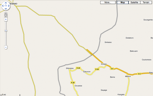
A good example of this is found when comparing Mali to Burkina Faso in West Africa. There are significantly more town names in Burkina Faso, and all the roads either have names or numbers. In Mali, which hasn’t been done yet, there are some major roads outlined, few towns are named, and no minor roads to speak of.
Also of interest, you’ll notice how the roads that should intersect at the borders, do not.
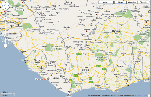
Here’s another interesting view of West Africa. You can clearly see that there has been a lot of data added for all of these countries, except for Liberia and Mali.
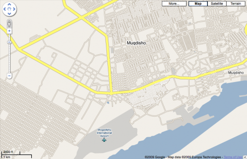
One other interesting map that I came across was of Mogadishu, Somalia. It appears that there either are no street names, or that the Google team working on this didn’t know what they were:


May 21, 2009 at 11:40 am
Wow! I’m moving to Guinea in August and have often wished that there was more data for Conakry. It’s a HUGE improvement. Thanks for the heads up!
May 21, 2009 at 12:22 pm
Isn’t a great deal of this sourced from the public? That might explain part of the disparity as countries like Mali and Liberia where internet is quite slow in general and maps are a hog for bandwidth, which you know well…
May 22, 2009 at 7:14 am
Wonder if Google plans to add StreetView for Mogadishu any time soon 🙂
May 23, 2009 at 11:30 am
gunna have to wait another decade for Sudan to show up, maybe another decade for S. Sudan 🙁
May 25, 2009 at 5:10 am
RDC but not congo-brazza, why ?
May 27, 2009 at 10:12 am
ohhh this is such wonderful news!!! flattening the world, i love it! thank you 🙂
May 29, 2009 at 8:04 am
Street names were very catch as catch can when I lived in Mogadishu over 20 years ago, I imagine it’s gotten worse since then
June 10, 2009 at 4:11 pm
I still don’t know why Google wouldn’t setup a way for us to give them the data. While looking at the map of Arusha, I’d been happy to draw little lines over the visible roads that weren’t mapped. OR correct the two roads they had mapped wrong. They allow it for correcting where a street address is in the states… but not the street.
July 3, 2009 at 7:01 pm
The reason for streets with no names in Mogadishu may be that Google used satellite pictures as a source for assisted map drawing. Does the Google Street View vehicle has an armored version ?
January 5, 2010 at 3:31 pm
Regarding the Mogadishu map: I was a Marine in Mogadishu in 1993. There are / were no signs or street names. The main roads had names (Afgoy, Medina, 21 October and Dead Cow Road that I can recall) but this was just passed along. No signs or makers. If any of the other roads had names, I imagine they have been lost or forgotten by now.
January 14, 2010 at 7:47 am
Wow, for a minute there I thought this site would entail white people feeding negative information about Africa. it’ll be cool though if we shared what is really happening in Africa